Sailing & marine systems Available
Telltale ↗
Our wind and wave models, tested against evidence. Boat-specific routing built on that foundation.
 WAYFARER LABSContact ↗
Independent engineering studio · Switzerland
Explore the products we build, the questions they answer and the work behind them.
Decades of experience across computer science, data science and product development.
Meet the creator ↗Sailing & marine systems Available
Our wind and wave models, tested against evidence. Boat-specific routing built on that foundation.

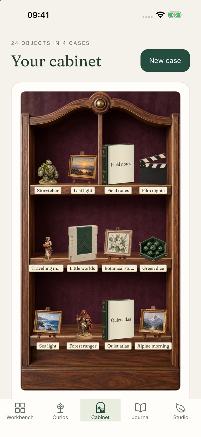
 APP CAPTURE + CABINET PREVIEW
Collections & making Available
Keep your hobbies, collections and creative projects connected.
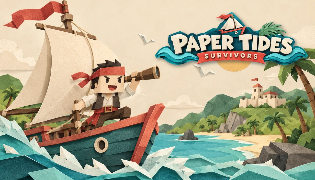 ILLUSTRATED KEY ART · IN TESTING
Games & interactive systems In testing
Paper Tides, Corporate Survivors and Dead End Department.
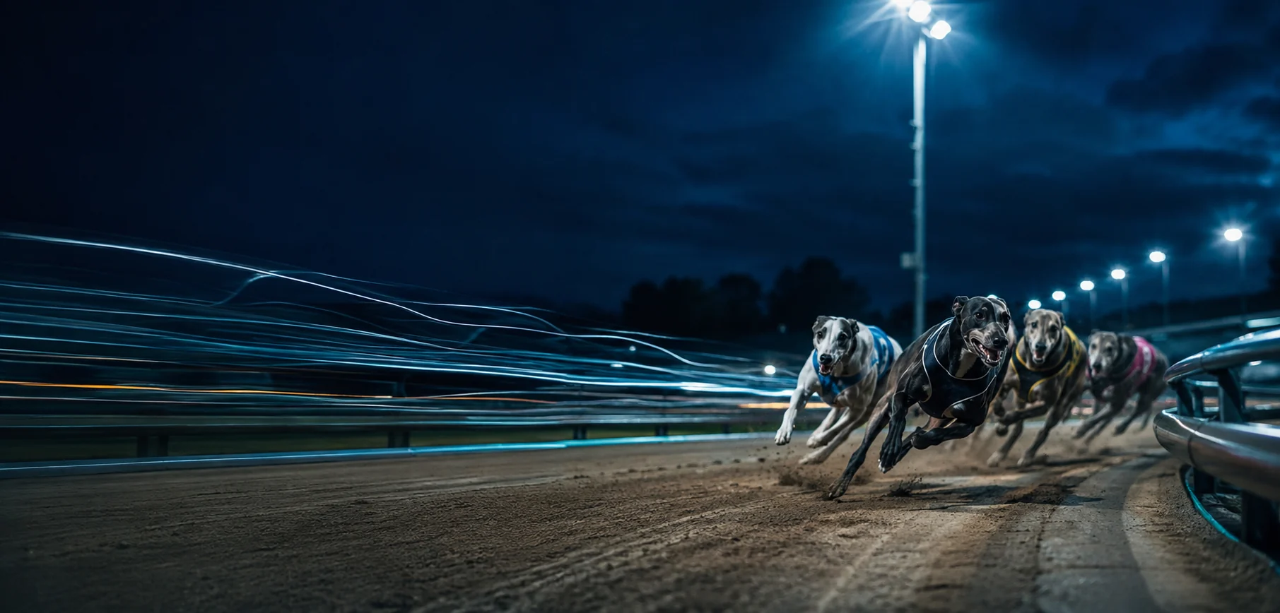 HOUNDHUNT · BRAND ARTWORK
Predictive modelling Available / private beta
Racing probabilities, the supporting data and the recorded outcomes.
About Wayfarer Labs
Independent engineering · Switzerland
Wayfarer Labs is built on decades of experience turning complex science and data into practical systems. Its creator holds a PhD in computer science and brings extensive director-level experience at a global healthcare company, leading work across strategic intelligence, data science and product development.
That work connects clinical science and operations with portfolio management, finance, manufacturing, regulatory affairs and patient advocacy. It uses digital twins, predictive engines and decision intelligence to understand complex systems, anticipate outcomes and support better decisions.
The same discipline shapes what we build here: make assumptions explicit, test predictions against reality, and give people information they can act on. For our marine systems, that means taking the work aboard boats, where real passages put the models, software and hardware to the test.
 Telltale
 · Sailing intelligence
Inspect the local wind field, compare the driving forecast and carry that context into a passage or anchorage decision.
Start on your phone or tablet.
Add a Bosun for continuous onboard operation.
Product support
Find setup instructions, understand a feature or report a problem.
Sign in, create an account, or connect a Bosun aboard.
Telltale · BosunWhat keeps working without internet, and what happens after.
Telltale · Instruments and gatewaysPresets, factory defaults, and why the defaults are often wrong.
Telltale · Keeping it runningWhat to look at, and what to collect.
Curio Studio · Product helpExport a complete backup or connect your Apple devices.
HoundHunt · Product helpRead probabilities alongside calibration and the recorded outcomes.
HoofHunt · Product helpHoofHunt is available to invited HoundHunt users.
Games · Product helpAsk about the game and device you want to test.
Race research / Greyhounds
Research Australian greyhound racing with Sergio, our in-house prediction model. Bring form, sectionals and race conditions together, then examine the evidence behind each assessment.
Open HoundHunt ↗HOW IT WORKS
Form, sectionals, track conditions and market history available before the race.
The same feature path serves model training and inference. Calibration is tracked by version.
Compare probabilities with results across the full sample, including losses.
Method & evaluation
Preserve the information cutoff, model version, predicted probability and available price. After settlement, inspect calibration, sample size and drift alongside returns. Time-ordered evaluation keeps later races separate from earlier training data.
Research and educational analytics. Probabilities do not guarantee outcomes. 18+.
Race research / Thoroughbreds
Sergio Thoroughbred combines form, sectional times, race conditions and weather for Australian and New Zealand racing. A dedicated model, within the shared HoundHunt research workspace.
Open HoofHunt · invited users ↗SYSTEM OVERVIEW
Inputs and assumptions remain attached to the result.
HOW IT WORKS
Recent form, sectionals, barriers, distance and class changes.
The going and weather add context to a runner’s history.
Race probabilities, market comparisons and settled results remain connected.
Method & evaluation
Sergio-T is a dedicated thoroughbred model. Its evaluation needs its own races, reference periods and outcomes. Results from greyhound racing are not evidence of performance on thoroughbreds.
Private research beta for invited HoundHunt users. No public subscriptions. 18+.
Marine hardware / Cooling, defrost & airflow
A retrofit controller designed to manage refrigeration automatically, coordinating compressor effort, intelligent defrosting and air circulation. Use temperature feedback and available power to maintain the required cooling while reducing avoidable energy use.
Discuss your installation ↗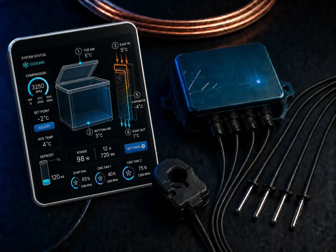
HOW IT WORKS
Five temperature points across the box, evaporator and airflow.
Coordinate compressor speed, defrost cycles and fan speeds within the configured temperature limits.
Schedule cooling around available power, with local control and optional Telltale integration for the boat’s energy budget.
Development & evidence
Initial integration targets Danfoss BD35 and BD50 compressors. The display brings temperature, power, energy and defrost information together. Savings must be established by comparing equivalent cooling work under measured conditions.
Development proposal. No measured energy-saving percentage is claimed.
SYSTEM OVERVIEW
Thermal feedback closes the loop.
Telltale adds energy context when connected.
Marine hardware / Windlass & thruster
A wireless handheld and base station for anchoring. Chain length, depth, scope and seabed context sit together, while the original footswitches and wired controls remain available.
Discuss compatibility ↗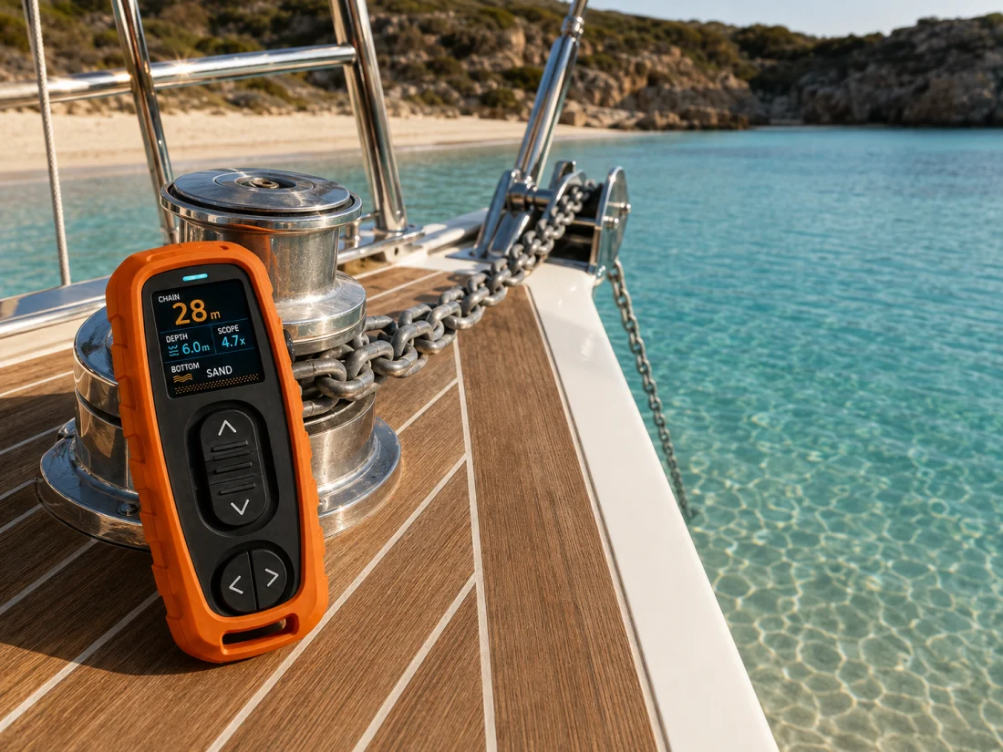
HOW IT WORKS
Distinct physical controls for windlass and bow thruster.
Chain count follows movement from the handheld or the boat’s original controls.
Measured chain length can feed the anchor watch and voyage log.
Development & evidence
The proposed architecture preserves the boat’s original controls. The fitted trial must verify command response, chain count and coexistence across both control paths. Standalone operation does not require an app or server.
In development. Fitted acceptance testing remains part of the release work.
PROPOSED CONTROL PATH
Original wired controls → windlass
Independent command path remains available.
Marine hardware / Machine vision
A stabilised thermal and daylight camera concept. Combine viewing angles with mast height and vessel attitude to estimate where a water-level contact lies.
Discuss the prototype ↗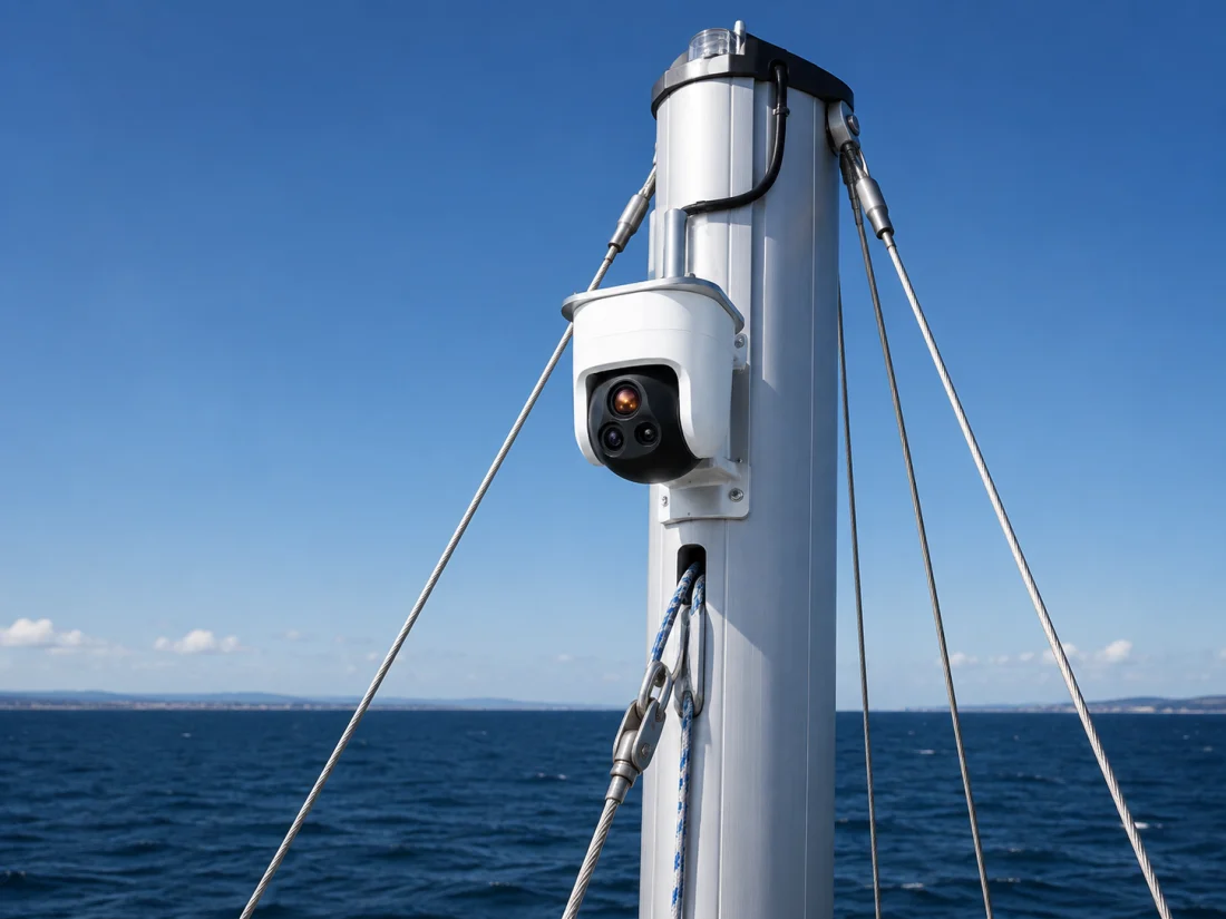
HOW IT WORKS
Thermal and daylight imagery from a stabilised masthead pod.
Mast height and corrected viewing angle estimate water-level range.
Telltale supplies heading, position and attitude for chart-referenced contacts.
Development & evidence
Passive ranging depends on the contact being at water level and on the accuracy of height and viewing angle. A near-horizontal sightline is particularly sensitive to angle error. The proposed laser rangefinder provides another measurement at suitable ranges.
Prototype programme. Published specifications are design targets until verified on a fitted unit.
MEASUREMENT CHAIN
r = h / tan(α)
Idealised water-level geometry, after attitude correction.
Joint development / Myto AG
An early-stage product developed with Myto AG. The work is independent of Telltale. Product features and release timing have not been announced.
Contact the lab ↗SYSTEM OVERVIEW
Inputs and assumptions remain attached to the result.
HOW IT WORKS
Establish the problem and the evidence needed.
Test the proposed approach with the development partner.
Release a specification when the evidence is ready.
Development & evidence
EvenKeel has its own development programme. This page provides a clear status and contact route without filling the gaps with speculative features.
Prototype with Myto AG. No public release date.
Collections, projects & making
A personal studio for hobbies, collections and creative projects. Keep records, photographs, methods and supplies together, from the first idea to the finished piece.
View on the App Store ↗Curious? Explore Curio Studio ↗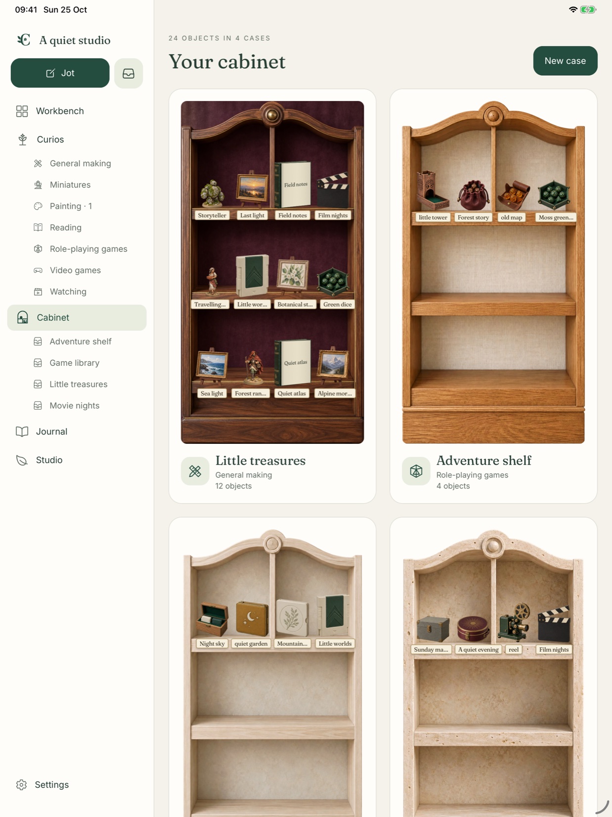
HOW IT WORKS
Development & evidence
Optional iCloud sync connects your own Apple devices. Complete backup exports include records and photographs. The support pages explain backup, recovery and app-lock behaviour before you need them.
iPhone and iPad. See the App Store for current availability and requirements.
The complete portfolio
Software, research, hardware and games. Each product has its own purpose, evidence and development status.
AvailableWind and wave models, with boat-specific routing.
 Available
Collections, projects & making
 In testing
Paper worlds and interactive systems.
 Available
Race research / Greyhounds
 Private beta
Race research / Thoroughbreds
 In development
Marine hardware / Cooling, defrost & airflow
 In development
Marine hardware / Windlass & thruster
 Prototype
Marine hardware / Machine vision
 Prototype
Joint development / Myto AG
Explore three games in development. See how each one plays and ask about joining the beta.
Sailing survivor rogueliteSteer through the fight while the cannons fire.
Public TestFlight beta Workplace survivor roguelite
Clear a route through the office.
TestFlight testing Lane defence with movable formations
Inspect the incoming threats and available budget.
TestFlight testingIllustrated key art above. Each game page includes a development gameplay capture.
Sailing survivor roguelite / Public TestFlight beta
Steer a paper ship through enemy fleets, line up broadsides and turn salvage into a vessel worth bringing home. Wind, tide and depth give the paper world a physical foundation.
Ask about the beta ↗Steer through the fight while the cannons fire.
Combine weapons, captain choices and refits.
Bank your haul and prepare for the next expedition.
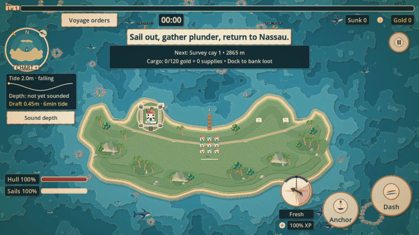
iPhone and iPad beta. Steam for Windows, Steam Deck and Linux is planned.
Beta help →Workplace survivor roguelite / TestFlight testing
Fight through micromanagers and office chaos, then hold a quiet desk long enough to do useful work. Your personal attacks pause while you work, so every productive moment has a cost.
Ask about the beta ↗Clear a route through the office.
Reach the required workstations and complete the assignment.
Make the exit or risk a little overtime.
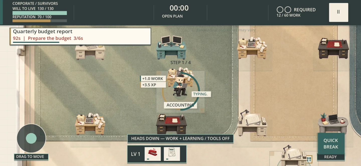
iPhone beta. PC and Steam Deck are planned.
Beta help →Lane defence with movable formations / TestFlight testing
Build a team and rearrange its formation as management changes the battlefield. Moving one colleague can rescue a lane, restore a useful bond or expose the rest of the office.
Ask about the beta ↗Inspect the incoming threats and available budget.
Choose colleagues and neighbours that work together.
Move desks with a shared cooldown. Every rescue creates a tradeoff.
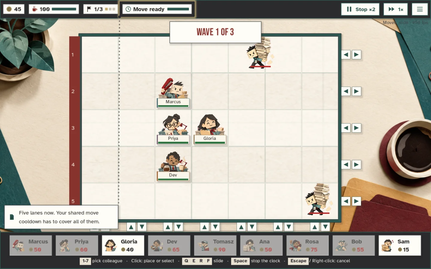
iPhone beta, with PC and Steam Deck development in progress.
Beta help →Wayfarer Labs / Methods across the portfolio
We work across numerical simulation, machine learning, sensing and embedded control. The common discipline is to represent the system carefully, preserve the evidence behind each output, and test it against the conditions it will encounter.
Telltale / Implemented models · validation scoped by study
Geospatial computing · Numerical physics · Route optimisation
Telltale combines atmospheric forecasts, terrain, coastlines, bathymetry and vessel data. Our wind and coastal-wave models calculate local physical responses; routing applies those fields to a particular boat and passage.
The scale of a passage calculation
Weather fields describe the area around a passage across time and model scenarios. The router then explores candidate courses using the boat’s performance and passage constraints.
scalar entries in the five-model corridor example below, including a separate directional wave field.
boat-speed evaluations across five weather scenarios with endpoints 100 nm apart.
of global ERA5 reanalysis available, combining observations with physical modelling since 1940.
A nominal 100 nm × 20 nm corridor, tiled at 500 m, gives 371 × 75 cells. Across 40 forecast snapshots:
| Spatial cells | 27,825 |
|---|---|
| Five model scenarios × eight variables | 27,825 × 40 × 5 × 8 44,520,000 scalar values |
| One 24-direction wave field | 27,825 × 40 × 24 26,712,000 directional entries |
| Combined inventory | 71,232,000 entries |
The eight example variables are two wind components, gust speed, wave height, period and direction, and two current components. The directional wave field is counted once, not once for each atmospheric model.
This is transparent sizing arithmetic, not an instrumented production payload. Model availability, native grids, coverage, masking, crop, cadence and enabled layers vary. It does not mean every source supplies every variable. These are scalar field entries, not independent observations, learned parameters or newly computed values for every route. Regional TCW and wave fields can be shared across many passages.
The current Python routing engine was run on five synthetic weather scenarios using one sample polar, a fastest-route objective and the benchmark’s all-sea geometry. Each case included wave fields and endpoints 100 nm apart.
| Boat-speed evaluations | 104,070 |
|---|---|
| Wind sampling calls | 3,474 |
| Marine sampling calls | 3,474 |
| Variability sampling calls | 3,469 |
| Returned route lengths | 103.5–108.5 nm |
Measured reference workload, not a typical-cost promise or a five-provider live comparison. Counts refer to function calls and can reuse cached values. They exclude TCW field construction and cannot be added to the field inventory as a total number of datapoints. Coastlines, wind, polar, objectives and search settings change the workload.
Inspect the recorded counts ↗ERA5 reconstructs global weather from 1940 onwards by combining observations with a physical atmospheric model. Our documented Mediterranean study uses selected historical periods and episodes, including a 2017–June 2021 reanalysis leg. Archive coverage is not a claim that the complete archive has been downloaded or that Telltale has been validated across every year.
ERA5 archive and methodology · ECMWF ↗Multidimensional fields vary across latitude, longitude, forecast lead and model run. Terrain and bathymetry have different resolutions; station observations and vessel streams have different footprints, clocks and uncertainty. Joining them requires explicit units, coordinate systems, masks and valid times.
Diagnostic wind downscaling combines stability-dependent lee wakes, ridge acceleration, channel effects and parametrised thermal circulation. A screened-Poisson correction, solved with conjugate gradients, adjusts horizontal flow around obstacles. The coastal-wave model transports directional energy through refraction, shelter, breaking and approximate diffraction and reflection.
Python, NumPy and SciPy support array computation and sparse numerical solves. Regional fields are built and published for reuse rather than recalculated for each viewer. Boat-specific polars and timed fields feed isochrone routing. The web app renders the resulting fields directly.
Historical reconstruction and operational forecast replay answer different questions. Retain the original run and lead, compare at the reference scale, and examine speed bias, direction error and behaviour by terrain regime. Observed station comparisons are distinct from showing a plausible-looking field.
cells in the documented 561 × 441 Ionian coastal-wave benchmark
direction bins in that benchmark configuration
paired comparisons in the separate regional forecast-selection study
The wave solver uses one representative period per cell, without currents or the full frequency spectrum. Diffraction is approximate. The wind model is diagnostic downscaling, not a full atmospheric simulation. Grid spacing is not an accuracy guarantee.
Numerical methods are present in the local model source. Benchmark dimensions are documented developer measurements, not a reproduced performance test. The 60,015 comparisons cover 45 stations and 1–48-hour leads for HRDPS/HRRR selection; they do not validate TCW terrain corrections.
Dataset complexity & scale
A forecast cube, a race-history table and a stream of camera frames pose different problems. Volume matters alongside resolution, coverage, information timing, missingness and the independence of observations.
We distinguish source coverage, data actually processed, training samples and independent evaluation samples. Each published figure should carry its period, configuration and purpose.